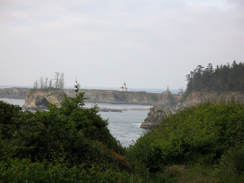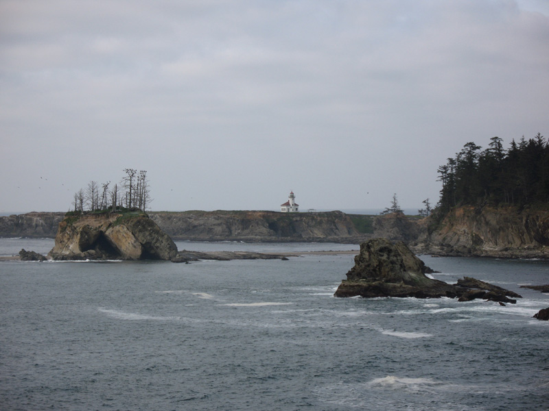
Cape Arago Lighthouse.
Long before white settlers arrived in 1853, the Coos Indians lived in villages near the bay, which now bears their name. Just south of Coos Bay and 2.5 miles north of Cape Arago (originally known as Cape Gregory), is a small, detached piece of land with sheer cliffs called Chief's Island by the Indians. The shape of the island has been aptly described as a bony right-hand fist, with an extended index finger pointing northward. It was on the tip of this finger-like extension that the first Cape Arago Lighthouse would be erected in 1866 (not shown).
After the arrival of white settlers, Coos Bay soon became one of the more important harbors along the Oregon Coast. As the shipments of lumber and coal from the bay grew, so too did the need for a navigational aid to guide vessels to the bay.
Oregon 's first lighthouse was built in 1855-1856 near the mouth of the Umpqua River, twenty-five miles north of Coos Bay. However, in 1861 the overflowing river undermined the brick tower, causing it to topple. By this time, the Coos Bay area had surpassed the Umpqua River region in commercial importance, and it was decided that the interests of commerce would be better served by a new light at Cape Arago, rather than reconstructing the light at Umpqua River. Funds were allocated accordingly, and Novermber 1, 1866, the first Cape Arago Lighthouse was illuminated.
The octagonal, wrought iron tower was capped with a lantern room housing a fourth-order Fresnel lens and was supported by spindly metal legs. Located at the northern end of the island, the tower was linked via a wooden walkway to a one-and-a-half-story wooden keeper's dwelling, constructed near the southern end of the island.
Rowboats were initially used to access the island, until a low bridge to the island was constructed in 1876. However, high seas cut short the bridge's life after just two years, and the boats were a necessity once again.
In 1878, a lifesaving station was established on the island. Three years later, the keeper of the station, Thomas Brown, was returning to the island from Empire City on Coos Bay, when he was caught in a storm and blown northward. The lifesaving keeper was now ironically in need of his own station's service. After a three-day battle, Brown was finally able to land his craft roughly ninety miles north of his intended destination. The lifesaving station was moved to the mainland in 1891, where it would be more accessible.
After the low bridge to the island was repeatedly washed away, bids were solicited in 1889 for the construction of a more robust high bridge, to link the island to the mainland. All of the submitted bids were deemed exorbitant, and a cable tramway was built instead in 1891. Two frame towers, one on the island and one on the mainland, supported a 400-foot long cable, and the ends of the cable were anchored in concrete. This new means of accessing the island also proved to be perilous. Just over a month before a high bridge was finally completed in July of 1898, keeper Thomas Wyman, his daughter, and two other individuals were being winched across the inlet in the cage suspended below the tramway's cable, when disaster struck. The cable snapped, plunging the passengers onto the rocky surf some sixty feet below. Wyman's legs were severely injured, and one of them was subsequently amputated.
In 1896, the Cape Arago Station received several improvements. The existing light tower was encased in bricks and covered with stucco. A brick fog building housing a Daboll trumpet was constructed adjacent to the tower, and a new duplex was built for the keepers.
When the fog signal had been in operation for just over ten years, erosion on the point endangered the lighthouse and fog building. A wood-frame fog signal building with an attached octagonal tower was built near the keeper's duplex. The light and fog signal began operation on July 1, 1909. The new tower was similar in appearance to the lighthouse that had been recently constructed at Mukilteo, Washington.
In 1934, the wooden lighthouse was moved a short distance to serve as the keeper's office, and Cape Arago's third lighthouse was constructed where the second lighthouse had stood. Perhaps seeking a more durable structure, the new lighthouse was constructed of concrete, using the plans from Washington's Point Robinson Lighthouse.
In mid-October of 2005, a notice was sent out to mariners by the Coast Guard stating that the Cape Arago Lighthouse would be deactivated. Chief Dale Dempsy, who is in charge of the aids to navigation team in Charleston, OR, says "no comments to speak of" were received, so he turned off the light on January 1, 2006. Of course, others besides mariners are interested in keeping the light active, and the deactivation has sparked a debate that hopefully will lead not only to reactivating the light but also to making the lighthouse accessible to the public.

