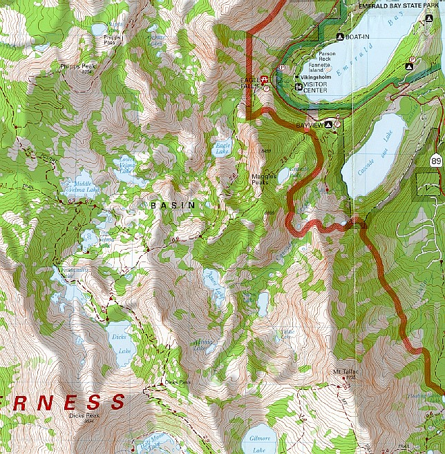

To find the beginning of our hike, find Emerald Bay in the upper right corner of this map. At the lower left of the bay you'll see a visitors center. If you draw a horizontal line from the visitors center until it intersects with highway 89, this was where we parked the car. Across the highway you see a picnic table symbol that says Eagle Falls. This is the trailhead. From there we followed the red dotted line down past Eagle Lake until we hit the fork. (below and to the left of the word "basin") We took the left fork to Dicks Lake. We stayed at Dicks Lake for 30 to 40 minutes and then headed back. Sounds simple right? Well, the real story of what happened that fateful day is include with the photos.